Missoula, MT to Columbia River...5 days
399 miles..12,680 feet climb
5114 miles total...190,105 feet climb total
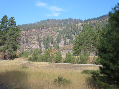
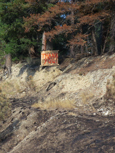
I will follow Highway 12 for the better part of five days from Missoula to the Columbia River. Ten days previous while on the way to Glacier NP I was cautioned about a forest fire in the Lolo area that eventually closed Highway 12. I checked with officials in Glacier and followed web-based reports about this growing fire and was prepared to alter my route because it looked like I might not be able to pass. A cool weather front and a little rain brought the needed results and the fire fighters brought the fire into containment over the Labor Day weekend when there were no forest service offices open or updates on the web for me to confirm this result. I continued riding south from Glacier to Missoula with heavy smoke shielding the nearby mountains, not entirely sure what my chances were that the road would be open. There was not a little concern as I passed my last westward option.
 |
| Fire line in Lolo National Forest |
 |
| Their home was 20 feet from fire line |
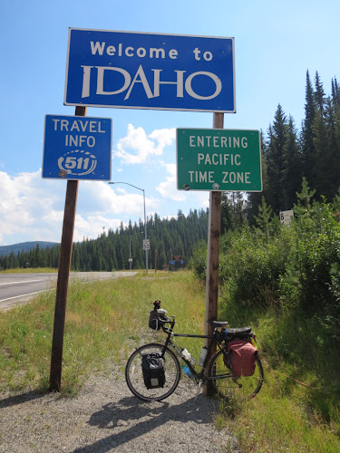
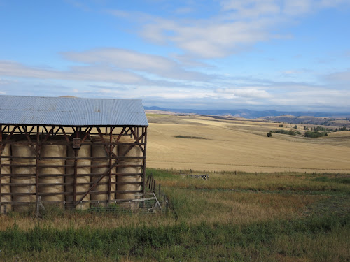
I had been keeping tenuous contact with the parent of my daughter's Tucson housemate that Jenny and I met in December 2011. Jeff, the dad, was hospitable to have me drop in for two days. Mom, Georgia, was out of town so we sort of bachelored it and ate out one night and cooked frozen bean burgers the next, followed by a walk to the nearby market for two containers of local ice cream that we nearly finished. Missoula is a great town. Thanks to the local university there are lots of young people. This always adds great vitality to a community. Missoula is the most bicycle using community I have yet seen. It's a flat city which helps. There are bike amenities everywhere, and lots of people of all ages using them. Adventure Cycling Association is based in Missoula. ACA does a wonderful job of advocating bicycle touring and the development of touring routes. They are the outgrowth of the 1976 Bikecentennial TransAmerica route that is still the primo choice to cross the country. I used their maps from Cincinnati to St. Louis. I am once again following their route from Missoula to Portland, leaving Missoula to connect with Highway 12.
 |
| Western boundaries are beginning to fall |
 |
| Lolo National Forest...Bitterroot Mountains |
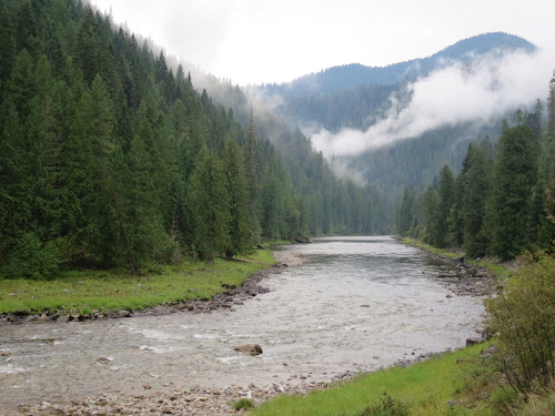
Much of Highway 12 traces the Lewis & Clark Expedition of 1805/1806. Traversing the Bitterroot Mountains southwest of Missoula, the Expedition encountered the most difficult portion of their journey. The mountains appeared to be a mass of steep, rugged hills with no path through. Coupled with early snow that drove game to lower regions the Expedition faced starvation and were forced to slaughter some of their weaker horses. They were well pleased when entering the Nez Perce village eventually on the west side and were offered salmon and winter lodgings. The Nez Perce led the whites on the return trip back over the Bitterroots on an ancient trail that today's road parallels. It is without doubt that not for the natives help, Nez Perce and other groups, the members of the Expedition likely would never have returned alive.
Years later when the whites wanted to establish the town of Lewiston, ID to service mining concerns, the Nez Perce said "Sure, go ahead. You may use our land." Little did they know that the whites took this as permanent. Eventually the US forced the Nez Perce to retreat to a reservation east of Lewiston. Someone found gold and as was customary of federal reactions, they found ways to reduce the original reservation to a tenth of its original size to feed the greed of a growing country. The attempt to escape to Canada by many Nez Perce led by Chief Joseph and the ensuing chase and battles by federal forces also wound its way across the Bitterroots. My route includes much of this history.
To the east of Lewiston I stop in Lapwai to visit a sacred Nez Perce site. A large pyramidal outcropping of rock known in mythological tales as "The Heart of the Dragon" symbolizes the origin and original homeland of the Nez Perce as a people. Just down the road on the Clearwater River is the Nez Perce National Historic Park with good exhibits of late 1800s Nez Perce clothing and utilitarian, hunting, domestic, and sacred implements. After a long day's ride of 90 miles and ascents totaling nearly 4500' I barely make it to the Historic Park to view the exhibits. Arrived at the Lewiston sate park of Hells Gate just at dark. I've put up my tent so often now I can literally do it with my eyes closed...in the dark anyway.
 |
| Western Idaho |
Why is it we name natural wonders after some imaginary sense of evil...Hells Gate, Devils Tower, Devils Courthouse?
 |
| Proceed as the way opens |
 |
| Western Idaho |
All that enter are not lost however...in Kamiah (Kam-e-i), ID is a fine bakery and restaurant that I frequented for dinner and breakfast...Hearthstone Bakery & Tea House. Camp in Kamiah was at the city park by the river with beautiful green grass. I was once told not to camp on anything green in the west for it means sprinklers will be operating. It has been said that someone woke up in the night as the force of the sprinkler their tent was set above sprayed through the bottom of the tent and soaked everything from the inside.
I chose the driest, brown spot I could find. It had rained that evening (while i was dining at the bakery...I have a good track record of evading rain) so I figured there would be no reason to water. At 5:00 AM I woke to the first signs of another rain. Then it quit. No, now it's raining again. That was short. The sprinklers were at play. There continued to do this repetitive rain shower for the next hour. Fortunately the sprinklers stopped before I struck camp...and packed a soggy tent.
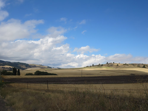
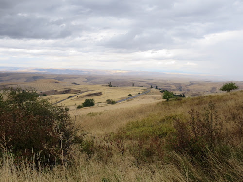
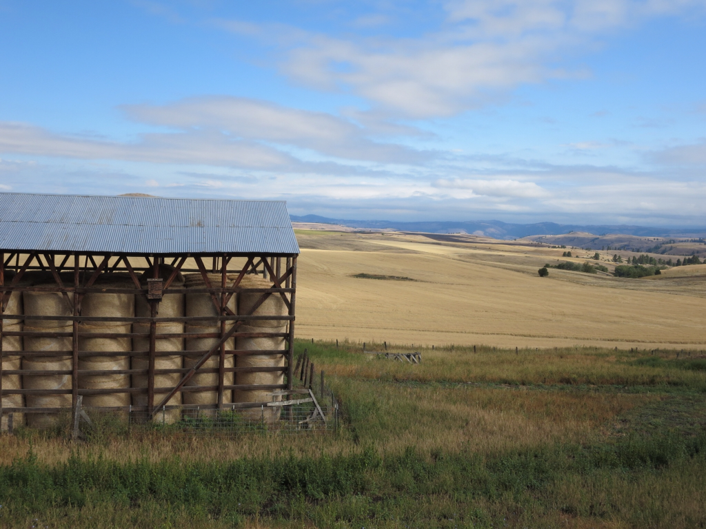
Departed Kamiah by going up. Crested onto a high plateau of rolling, wind-driven hills of wheat. From the community of Winchester there was a sweet 3,000 feet descent into the lower valley and toward Lewiston on a twisty, open view, smooth asphalt road...a bicyclist's delight.
 |
| 3000' descent...Blackie's not looking thrilled |
 |
| Curvy roads...yea! |
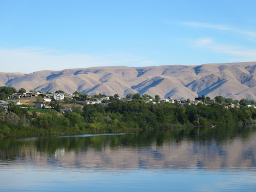 |
| From Lewiston looking to Clarkston |
 |
| One more down |
 |
| The miles are adding up |
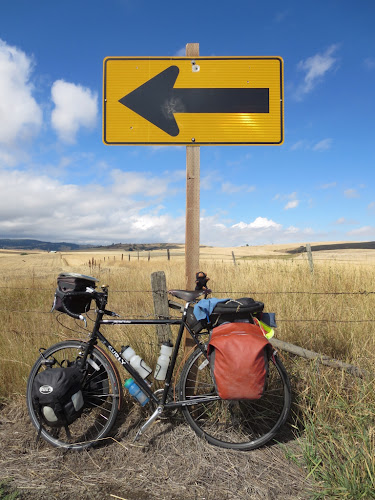
My last day on Highway 12 seemed to drag on. I was tired. The road had gentle grades; any head winds were only mild; there was moderate traffic and lots of trucks, but the drivers are mostly courteous and give way. There wasn't any reason for my funk. That morning the rear tire went flat from a sliver of metal picked up on the shoulder. Highway 12 has adequate shoulders for most of its course. On this day though, the Idaho boys were exceptionally focused on aiming empty beer bottles at road signs, bridge abutments, and guardrails. Riding over glass freaks me out, but I have not had any flats this tip from glass...although glass probably sliced the rear sidewall leading me to buy a new tire several weeks past. I've written before about the wonders of what can be found along side our roadways. I had to ride on the shoulder for the other traffic, keeping a foot off the fog line unless I saw oncoming traffic veer over...meaning both lanes would be passing me at once and I recognized the need to open the eye of the needle for the semi coming from behind. Combined with the traffic load and shoulder debris I had to keep a pretty keen eye on the pavement immediately before me. Bicycles rolling at 10-15 mph tend to keep a straight line, but if I shift my weight slightly to a side the bicycle balances the center of mass and shifts to the other. Many times this slight movement has saved the day at the last moment...like the screw stuck in the tar patch with point side up. Yeah, that'd be good for my tire!
I think this nearly constant scanning for debris was wearing on me. I couldn't scan the horizon or gaze at the passing points of interest except for what was directly ahead. Not to mention that I think I had finally reached my fill of sagebrush and scrub grass. So much of western soil is very thin that little grows. It is easy to spot wet drainages due to the cottonwood trees that may be the only tall, green element on the landscape. This is all so very different from our eastern hardwood forests. Am I getting homesick?
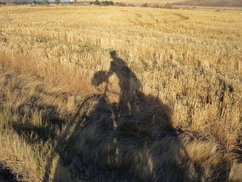 |
| Ghost rider |
Then with little warning Highway 12 drops elevation and there in front of me is the Columbia River...or Lake, since most of it is behind dams. I turn onto a new road.
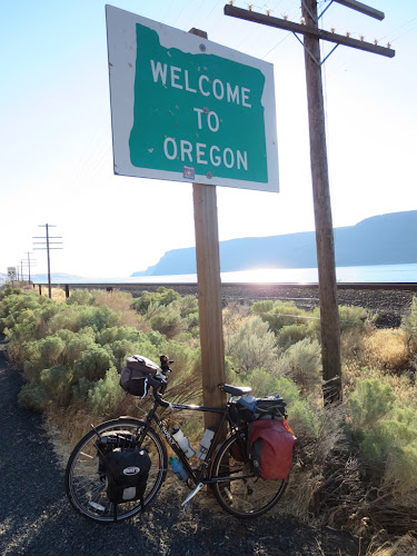 |
| The last frontier |
 |
| Columbia River |
For the Bicyclist tourist...
- Missoula (back to using Adventure Cycling Lewis & Clark Bicycle Trail map from Missoula to Portland), Highway 12 (primary route to Columbia River), Lolo, Lolo Pass, Bitterroot Mountains, Wilderness Gateway NF camp
- Wilderness, Highway 12, Kamiah (Kam-e-i), Nez Perce Reservation, Highway 162, Highway 7, Green Creek Road, Jentges Road, Highway 95, Craigmont, Lapwai (Nez Perce Heart of the Dragon homeland), Nez Perce National Historic Park, Lewiston, Hell Gate SP camp
- Lewiston, Highway 12, Clarkston, Pomeroy, Dayton, Lewis & Clark SP camp
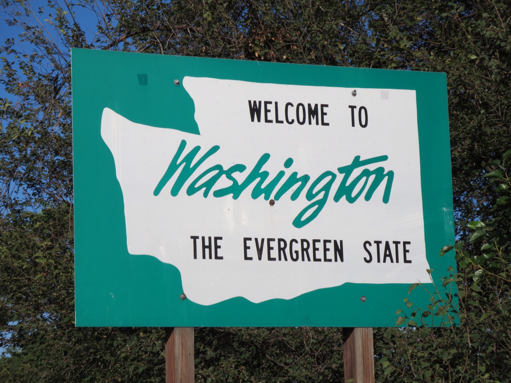
- Dayton, Highway 12, Waitsburg, Walla Walla, Old Highway 12, Highway 12, Touchet, Highway 730 at Columbia River, Hat Rock SP camp


Wahoo! (Etc.)
ReplyDelete